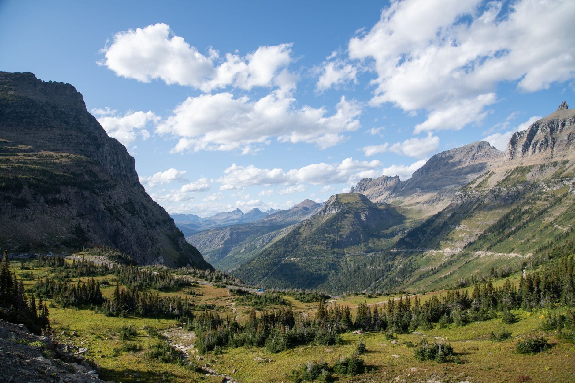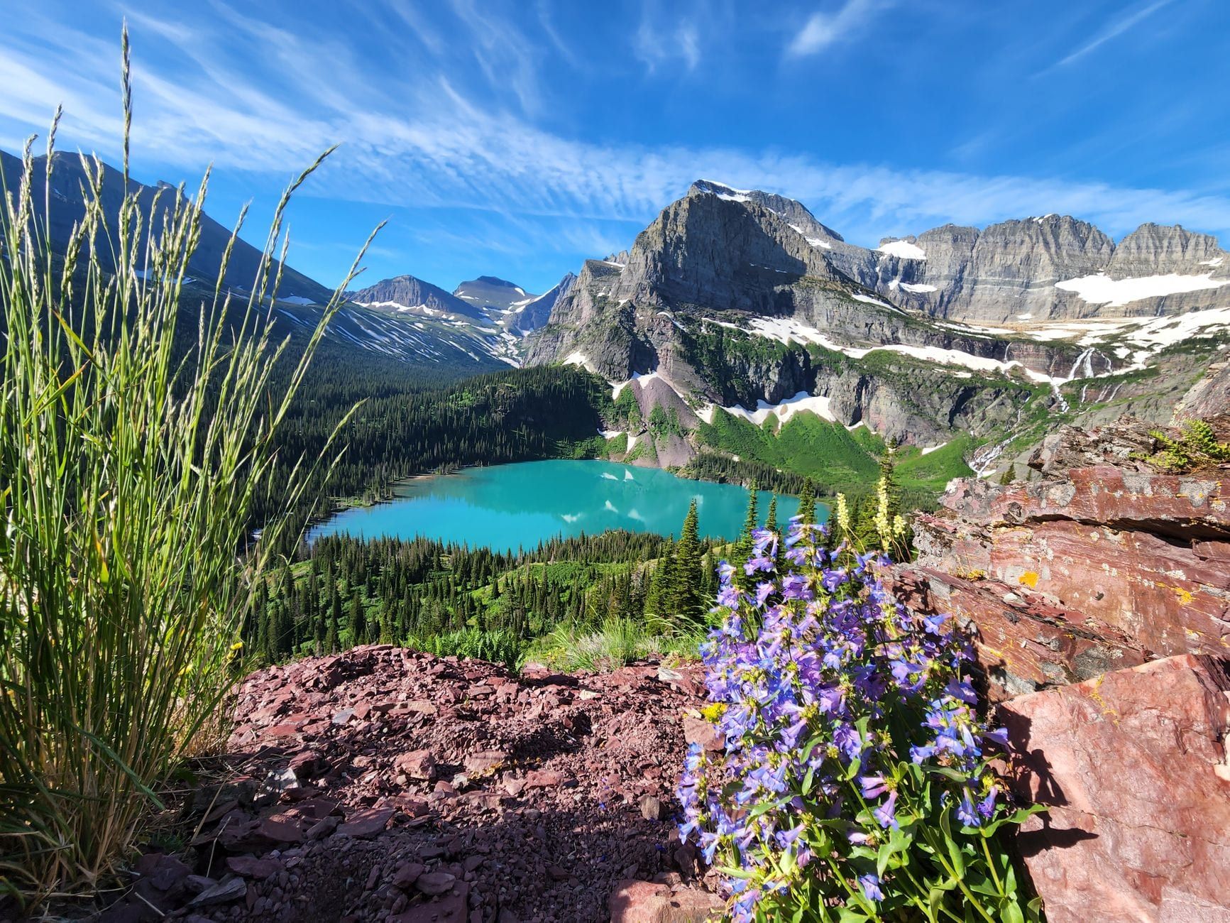
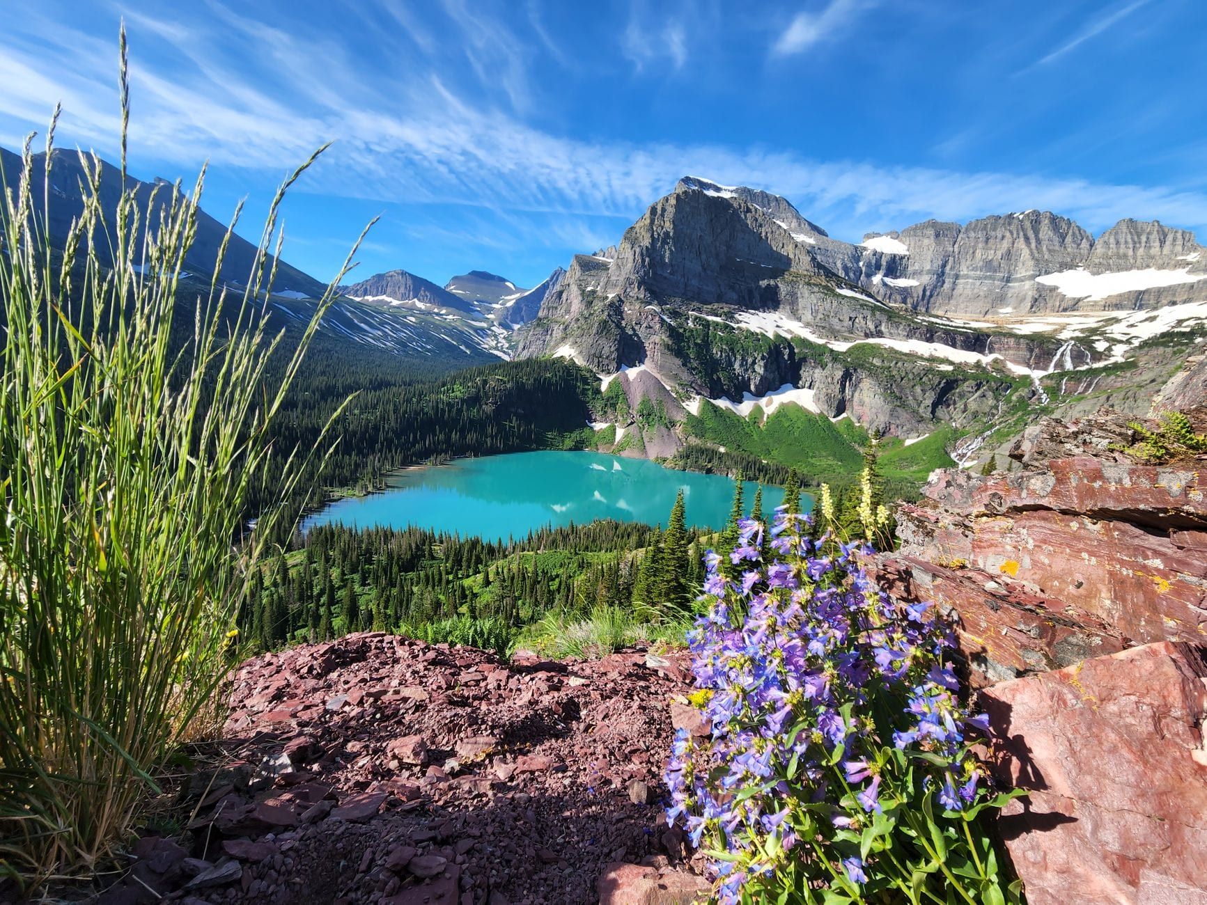
The Highline Trail cuts along a narrow shelf blasted into the Garden Wall, with Going-to-the-Sun Road disappearing hundreds of feet below and the Continental Divide running the length of the horizon. It starts across from the Logan Pass Visitor Center at 6,646 feet and stays above treeline for most of its run, which is why it's the trail every Glacier itinerary keeps coming back to.
This guide sorts out the conflicting mileage claims you'll find elsewhere, walks through the route options, and covers what actually changed for 2026: Glacier dropped its vehicle-reservation system but added a three-hour parking cap at Logan Pass and a new ticketed shuttle. Here's what you need to plan the hike properly, mile by mile, gear list included.
Highline Trail at a Glance
Logan Pass to Granite Park Chalet is 7.6 miles one-way; continue over the Loop Trail and you've done 11.8 miles one-way to The Loop parking area. Turn the Chalet trip into an out-and-back and it's 15.2 miles round trip. Short on time? Haystack Pass and back is 7.2 miles round trip and doable as a half-day.
| Route option | Distance | Elevation change | Typical time |
|---|---|---|---|
| Haystack Pass round trip | 7.2 miles | +624 ft / -253 ft | 5-6.5 hours |
| Logan Pass to Granite Park Chalet (one-way) | 7.6 miles | ~690-830 ft gain | 4-5 hours |
| Out-and-back to the Chalet | 15.2 miles round trip | ~1,400-1,660 ft round trip | 8-10 hours |
| Logan Pass to The Loop (one-way) | 11.8 miles | +830 ft, then -2,000 ft on the Loop Trail | 7-9 hours |
Elevation gain to the Chalet runs 690 to 830 feet depending on whose GPS you trust, and it's concentrated in one climb: 275 feet of switchbacks up to Haystack Pass at mile 3.6, the high point of the standard route at 7,024 feet. Past the Chalet, the Loop Trail loses nearly 2,000 feet over 4.2 miles — that's the leg hikers underestimate.
You'll see the one-way distance quoted anywhere from 11.8 to 13.3 to 16 miles. The gap comes down to what's being measured: official trail-sign mileage lands near 11.8 miles for Logan Pass to The Loop, GPS tracks run a bit long around the switchbacks, and hikers who add the Grinnell Glacier Overlook spur sometimes fold that mile-plus of extra climbing into their total. Plan around 11.8 to 12 miles for the standard hike, and add distance deliberately for side trips instead of being surprised by it.
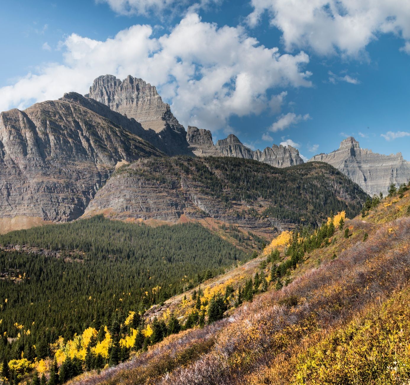
Which Route Should You Hike? (Loop vs. Out-and-Back vs. Shorter Options)
Four ways to hike the Highline, and the right one depends on your legs, your time, and whether you've got a second car.
| Logan Pass to The Loop (one-way) | Out-and-back to Granite Park Chalet | |
|---|---|---|
| Distance | 11.8 miles one-way | 15.2 miles round trip |
| Elevation profile | Gains ~830 ft to Haystack Pass, then loses ~2,000 ft down the shadeless Loop Trail | Same climb both directions — no descent through the burn area |
| Logistics | Needs the shuttle or a second car staged at The Loop | Park once at Logan Pass, no shuttle required |
| Best for | Hikers okay with a long, knee-jarring downhill and shuttle timing | Hikers who want the option to turn back anytime |
Short on a full day? Turn around at Haystack Pass, 3.6 miles in, for a 7.2-mile round trip with 624 feet of gain and 253 feet of loss — about five to six and a half hours including lunch at the pass. It's the version to pick if you're hiking with kids or reached Logan Pass too late for a full Loop attempt.
Backpackers can keep going past Granite Park Chalet toward Swiftcurrent Pass and down into Many Glacier, or north to the Fifty Mountain campground roughly 12 miles beyond the Chalet junction. Both extensions need a wilderness permit and a plan for getting back to your car.
Start at Logan Pass, not The Loop. Hiking Logan Pass to The Loop is mostly downhill after that first climb; reverse it and you're grinding uphill through an old burn scar with no shade, usually in the heat of the afternoon. Starting at Logan Pass also puts the morning sun at your back along the Garden Wall instead of in your eyes.
How Hard Is the Highline Trail, Really?
It depends which 0.3 mile you're asking about. The Ledge, right at the trailhead, is a 6-to-8-foot-wide shelf with a sheer 100-plus-foot drop and a rubber-coated steel cable bolted to the rock for handholds — that's the section that scares people, not the overall grade.
Past the Ledge, the trail settles into a gentle traverse. Total gain to Granite Park Chalet is only 690 to 830 feet, spread over 7.6 miles. Length wears hikers out more than steepness does, especially once you add the Loop Trail's 2,000-foot descent or the Grinnell Overlook's 900-foot climb on top.
Shade disappears once the sun clears the peaks, and the Loop Trail's burn-scarred switchbacks have almost none. Add in the altitude — Logan Pass sits at 6,646 feet, and Haystack Pass tops 7,000 — and hikers arriving straight from sea level often feel the thinner air on the climbs.
Skip it if you're not comfortable with exposure — there's no detour around that first 0.3 mile. Guides also flag the full Loop version as a poor fit for young kids, given the distance, sun, and continuous cliff edge; the shorter Haystack Pass turnaround is the better family call.
2026 Logistics: Parking, Shuttles, and Reservations
Glacier dropped its vehicle-reservation system for 2026, but getting to the Highline trailhead still takes planning.
Private vehicles can still park at Logan Pass, but only for three hours starting July 1, 2026 (weather permitting) — not enough time for the hike to The Loop, and tight even for the Haystack Pass shortcut. That cap is why most Highline hikers now plan around the shuttle instead of driving.
The 2026 Logan Pass Express Shuttle runs July 1 through Labor Day, September 7, and costs $1 per person for anyone age 2 and up. Tickets go on sale on Recreation.gov 60 days out starting May 2 at 8am MDT, with a next-day release window added from June 30 at 7pm MDT. There's no buying a ticket in person, so book ahead.
The Loop is a shuttle stop, not a boarding point, so it exists mainly to pick up hikers finishing the Highline. Figure on a 30-minute ride back up to Logan Pass, and note there's no drinking water at The Loop, so don't plan on refilling there. Afternoon pickup backs up fast since most Highline hikers converge on that stop within the same two- or three-hour window.
You still need a standard park entrance pass or an annual pass — dropping vehicle reservations didn't drop the entry fee. And if you're driving any part of Going-to-the-Sun Road yourself, vehicles over 21 feet long or 8 feet wide aren't allowed past Avalanche Creek; The Loop's hairpin curve is part of why.
On busy July and August mornings, the Logan Pass lot has historically filled by 7:05 to 7:10am, with cars circling for open spots by 7:20. Get there before 7am, or plan on the shuttle instead.
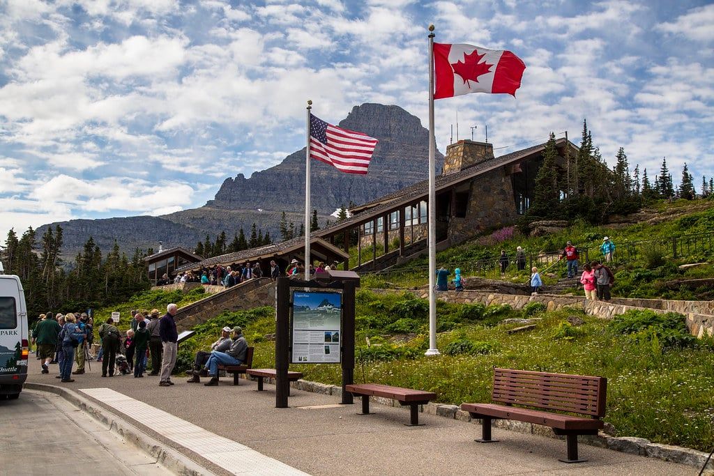
Best Time to Hike the Highline Trail
Early July through mid-September is the reliable window, and it starts later than most first-time visitors expect.
The Highline doesn't usually open until around July 1, once snow clears the Garden Wall traverse, and the park can't pin down an exact date. Spring storms and avalanche conditions push it back some years, and Logan Pass itself only opens to vehicles once plowing finishes on the alpine section.
Morning is your friend twice over: the parking lot fills by 7am, and the Garden Wall stays shaded for the first couple of hours because the parallel ridgeline blocks direct sun. That shade burns off by mid-morning, so an early start beats the crowds and the sunburn at once — nearly every hiker who finishes at The Loop ends up burned somewhere.
Early July and late September carry snow-and-ice risk on the Ledge specifically, so pack microspikes if you're hiking either end of the season. Shuttle hours also shrink outside the July-through-Labor-Day window, so shoulder-season hikers should plan their own transportation.
Mile-by-Mile: What to Expect on the Trail
Here's the hike broken into its five natural stages, from the trailhead cable to the final descent, so you know what's coming and where the good turnaround points are.
The Ledge (Mile 0 to 0.3)
The trail leaves the road right across from the Logan Pass Visitor Center and narrows immediately. For about three-tenths of a mile it's 6 to 8 feet wide with a sheer drop of 100 feet or more on the downhill side; a rubber-coated steel cable, installed by the park, gives you something to hold. Most hikers find it's over faster than they expected — the anxiety beforehand is worse than the walking itself.
The Garden Wall Traverse to Haystack Pass (Mile 0.3 to 3.6)
Past the Ledge, the trail eases into a long, fairly flat traverse below the Garden Wall, crossing streams and wildflower meadows with bighorn sheep sometimes grazing right along the path. Give them room; they've been known to charge hikers who crowd them. About three miles in, look at the boulders — some contain visible stromatolite fossils, 1.5-billion-year-old cyanobacteria remnants from the ancient Belt Sea, preserved in the limestone underfoot.
The one real climb of the day comes next: 275 feet of switchbacks up to Haystack Pass at mile 3.6, elevation 7,024 feet. It's the trail's high point and a natural lunch stop, with views down both sides of the Divide.
Haystack Pass to Granite Park (Mile 3.6 to 7.6)
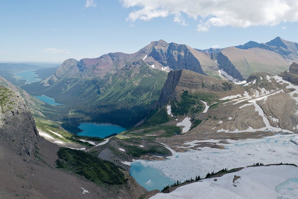
From the pass, the trail contours toward Granite Park with the valley opening up below — a textbook U-shaped trough carved by glaciers. At mile 6.9, a spur breaks off toward the Grinnell Glacier Overlook: a steep 0.8-to-1-mile climb gaining 900 to 1,000 feet to a Continental Divide viewpoint over the Salamander and Grinnell Glaciers. It's worth the extra sweat if your legs have it, but skip it if you're already running late for the shuttle.
Just before the Chalet, a separate 0.8-mile spur climbs to Swiftcurrent Pass on the ridge, the connector route toward Many Glacier for anyone continuing as a backpacking trip.
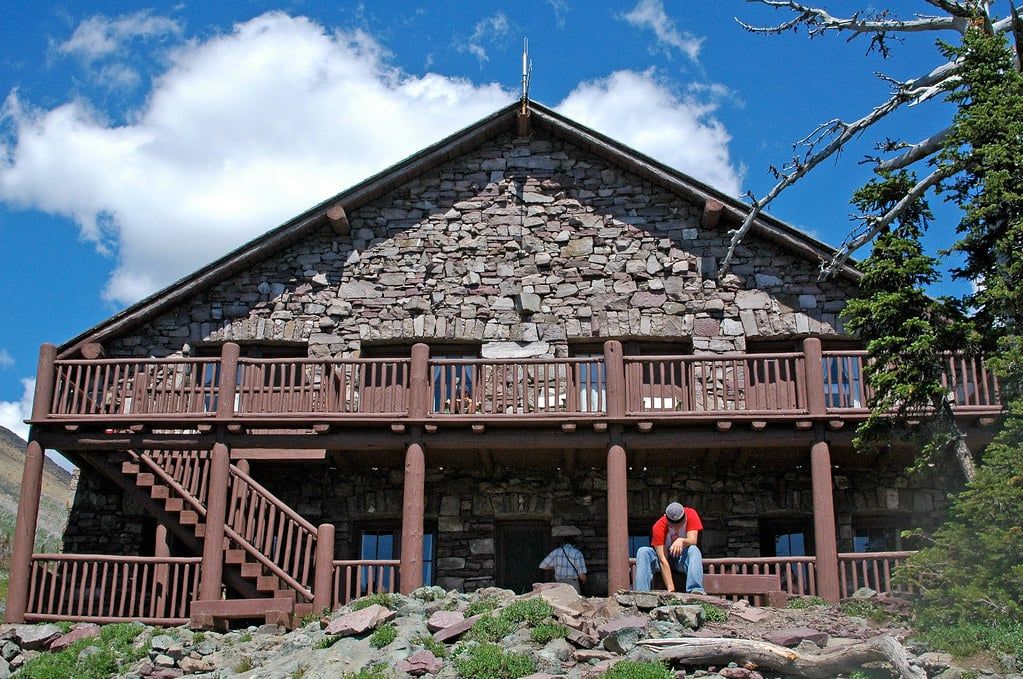
Granite Park Chalet (Mile 7.6)
The Chalet is a stone building from 1914-1915, built by the Great Northern Railway and now a National Historic Landmark. It's the only spot with restrooms between Logan Pass and The Loop, and day hikers can buy packaged snacks and bottled water when it's in stock. Bring cash — cards don't always work this far from the grid.
The Loop Trail Descent (Mile 7.6 to 11.8)
From the Chalet, the Loop Trail drops almost 2,000 feet over 4.2 miles of switchbacks through the 2003 Trapper Creek Fire scar, which burned more than 19,000 acres. Losing the tree cover means a clear, constant view of Heavens Peak across the valley, but it also means zero shade during the hottest part of the afternoon. Trekking poles earn their keep here — the grade is steady and the surface loose in spots.
Granite Park Chalet: Lodging and Camping Options
Day hikers get restrooms, a covered porch, and whatever snacks and bottled water are in stock, cash only. Don't count on a big selection late in a supply run.
Overnight guests need a reservation through graniteparkchalet.com. The Chalet has 12 rooms with 2 to 6 bunks each, no electricity, and a shared kitchen with a propane stove for cooking your own food. Rooms fill early for peak summer dates.
Four individual wilderness campsites sit near the Chalet, booked through the NPS Backcountry Office. You can only stay one night at this site, and your permit has to include a second night of backcountry camping elsewhere in the park. It's not set up as a standalone base camp.
Wildlife and Safety on the Highline
The Highline runs through some of the densest grizzly habitat in Glacier, and the park's guidance is blunt: carry bear spray, make noise, and hike in groups.
The route's grimmest chapter came on August 13, 1967, the 'Night of the Grizzlies,' when a bear killed a 19-year-old woman near Granite Park Chalet — one of two fatal attacks that happened the same night in different parts of the park. It's still the reference point for why bear protocol on this trail isn't optional.
Beyond bears, expect mountain goats, bighorn sheep, marmots, ground squirrels, and deer along the route. Pikas are common too, gathering upward of 30 pounds of grass each summer to survive a nine-month winter under the snow. Bighorn sheep sometimes show up right near the trailhead; admire them from a distance, since they've charged hikers who got too close.
There's no cell coverage anywhere along the trail outside Apgar and St. Mary, so tell someone your plan before you set out. Separated hiking parties account for more than three-quarters of the park's search-and-rescue calls. Stay together, especially through the Ledge and the burn area, where footing gets loose.
What to Pack for the Highline Trail
Pack for a hike with no reliable water source and a 40-degree temperature swing.
- At least 2 liters of water per person — nothing to filter, only Chalet purchases 7.6 miles in
- Layers: mornings can start near 48°F, afternoons climb into the 90s
- Sun protection — hat, sunglasses, a hooded sun shirt beats reapplying sunscreen all day
- Bear spray, carried where you can reach it fast
- Rain jacket for sudden afternoon mountain storms
- Microspikes if hiking in early July or after mid-September, for ice on the Ledge
Trekking poles help on the Loop Trail's knees-first descent, binoculars pay off at Haystack Pass and the Grinnell Overlook, and a stash of cash covers snacks at the Chalet.
FAQs
Frequently asked questions
How long is the Highline Trail in Glacier National Park?
It depends on the route. Haystack Pass and back is 7.2 miles. One-way to Granite Park Chalet is 7.6 miles, or 15.2 miles round trip. Continue over the Loop Trail to The Loop and you've covered about 11.8 miles one-way, though some GPS tracks with the Grinnell Overlook side trip added read closer to 16 miles.
How hard is the Highline Trail?
Moderate to strenuous, depending on which version you pick. The Highline segment gains only 690 to 830 feet over 7.6 miles, but the Ledge's cliff-edge exposure at the start and the Loop Trail's nearly 2,000-foot, shadeless descent push it into strenuous territory for a lot of hikers.
Do I need a permit or reservation to hike the Highline Trail?
Not for a day hike — no wilderness permit is required. You do need a standard park entrance pass, and since Logan Pass parking is capped at three hours in 2026, most day hikers book a $1 Logan Pass Express Shuttle ticket through Recreation.gov instead of driving.
Is the Highline Trail safe for kids?
Kids who can handle the Ledge's narrow, cable-protected cliff edge and a full day of hiking can do it, but the full Loop version isn't considered kid-friendly given the distance, sun exposure, and continuous drop-offs. The Haystack Pass turnaround, 7.2 miles round trip, is the better family-sized version.
When is the best time to hike the Highline Trail?
Early July through mid-September, once snow clears the Garden Wall traverse — the exact opening date shifts year to year with snowpack. Start early: parking fills by around 7am, and the trail stays shaded for the first couple of hours before the sun takes over.
Can you see grizzly bears on the Highline Trail?
Yes, the entire route runs through grizzly habitat, so carry bear spray, make noise, and hike with others. Granite Park Chalet was the site of a fatal grizzly attack in August 1967, one of two the same night in what's remembered as the Night of the Grizzlies.
Which direction should I hike the Highline Trail?
Start at Logan Pass. That direction is mostly downhill to flat, while starting at The Loop means grinding uphill through an old burn scar with little shade. It also puts the morning sun at your back along the Garden Wall.
Is there water available on the Highline Trail?
Not reliably. There's a potable fountain at the Logan Pass Visitor Center, and bottled water is sometimes sold at Granite Park Chalet 7.6 miles in (bring cash), but there's nothing to filter along the way. Carry at least 2 liters per person.